# Debugging international names
If there is an issue about international names not being displayed correctly, first, we need to find one specific example item and check at which stage does the problem appear.
OpenFreeMap map data is created by the following stack:
**OpenStreetMap data ➔ OpenMapTiles specification ➔ Planetiler**
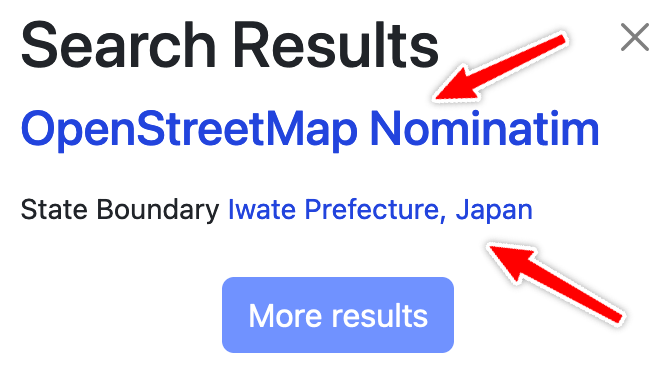
1. To debug OpenStreetMap data, go to OpenStreetMap.org and search for the query string. For example "Iwate Prefecture" gives these results: [nominatim](https://nominatim.openstreetmap.org/ui/details.html?osmtype=R&osmid=3792412&class=boundary) and [openstreetmap](https://www.openstreetmap.org/relation/3792412)
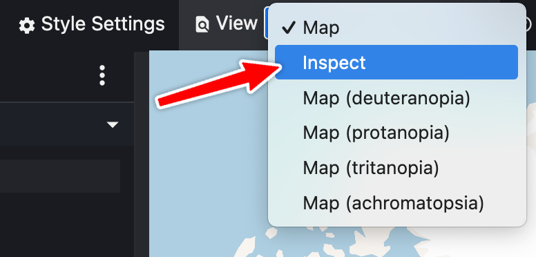
 2. Then we need to check what the data is in the generated vector tiles. The best way to do this is to go to [Maputnik editor](https://maputnik.github.io/editor?style=https://tiles.openfreemap.org/styles/bright) and select View / Inspect.
 3. Then you can search for the little red dot matching your label and make a screenshot.
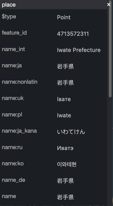 Now we can compare where the naming problem is coming from.
## Next steps
It'd be nice to compare with other OpenMapTiles implementations like [tilemaker](https://github.com/systemed/tilemaker) or the [OpenMapTiles reference](https://github.com/openmaptiles/openmaptiles). I don't have full planet datasets from these implementations currently, so if someone is willing to run one it'd be a great contribution.
Now we can compare where the naming problem is coming from.
## Next steps
It'd be nice to compare with other OpenMapTiles implementations like [tilemaker](https://github.com/systemed/tilemaker) or the [OpenMapTiles reference](https://github.com/openmaptiles/openmaptiles). I don't have full planet datasets from these implementations currently, so if someone is willing to run one it'd be a great contribution.